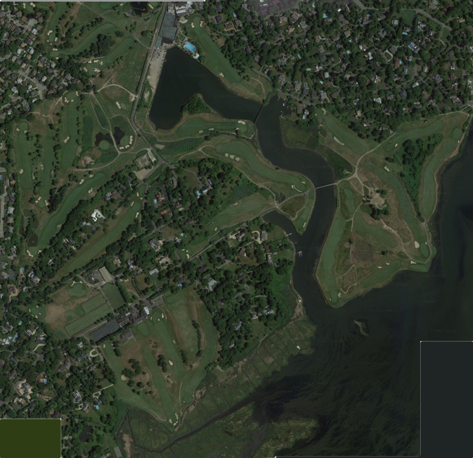
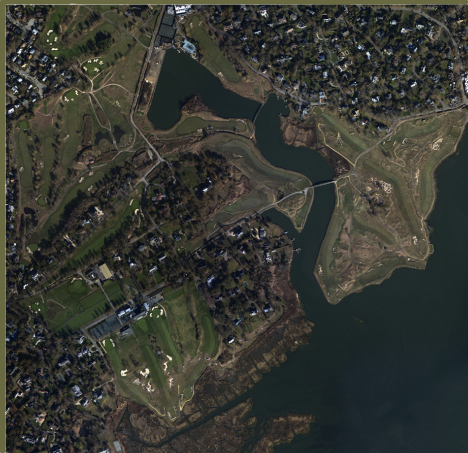
Move fader, located beneath image, from right to left to fade image back in time. Position the fader to the extreme left to see pre-Sandy image; position fader to the extreme right to see post-Sandy image.
Note: slider optimized for Firefox and Safari browsers, does not function properly in most versions of Internet Explorer.
Note: post-Sandy image taken 4 November 2012. Pre-Sandy image retrieved from Google Maps 16 November 2012; originally captured by Google date uncertain.
Sources: Bluesky, DigitalGlobe, GeoEye, New York GIS, USDA Farm Service Agency, Google; "Hurricane Sandy: Rapid Response Imagery of the Surrounding Regions," Department of Commerce (DOC), National Oceanic and Atmospheric Administration (NOAA), National Ocean Service (NOS), National Geodetic Survey (NGS), Remote Sensing Division, publication date 2012 Nov 15. Slider design by Matt Smith.